Description
Course Name: Diploma in Remote Sensing & Land Surveying
Course Id: DRSLS/Q0101.
Eligibility: 10+2 (Higher Secondary) or equivalent is required.
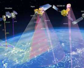
Objective: The Diploma in Remote Sensing & Land Surveying is designed to provide students with specialized knowledge and technical expertise in modern surveying methods and geospatial technologies. The course covers key areas such as remote sensing principles, satellite imagery analysis, photogrammetry, GIS (Geographic Information Systems), GPS-based surveying, cartography, and digital mapping. Students also learn about land use planning, environmental monitoring, resource management, and urban development applications.
Duration: 400 hrs (Equivalent to One Year)
 How to Enroll and Get Certified in Your Chosen Course:
 Step 1: Choose the course you wish to get certified in.
Step 2: Click on the “Enroll Now” button.
Step 3: Proceed with the enrollment process.
Step 4: Enter your billing details and continue to course fee payment.
Step 5: You will be redirected to the payment gateway. Pay the course and exam fee using one of the following methods:
Debit/Credit Card, Wallet, Paytm, Net Banking, UPI, or Google Pay.
Step 6: After successful payment, you will receive your study material login ID and password via email within 48 hours of fee payment.
Step 7: Once you complete the course, take the online examination.
Step 8: Upon passing the examination, you will receive:
• A soft copy (scanned) of your certificate via email within 7 days of examination.
• A hard copy (original with official seal and signature) sent to your address within 45 day of declaration of result.
Step 9: After certification, you will be offered job opportunities aligned with your area of interest.
Online Examination Detail:
- Duration- 120 minutes.
- No. of Questions- 60. (Multiple Choice Questions).
- 10 Questions from each module, each carry 10 marks.
- Maximum Marks- 600, Passing Marks- 40%.
- There is no negative marking in this module.
| How Students will be Graded: | ||
| S.No. | Marks | Grade |
| 1 | 91-100 | O (Outstanding) |
| 2 | 81-90 | A+ (Excellent) |
| 3 | 71-80 | A (Very Good) |
| 4 | 61-70 | B (Good) |
| 5 | 51-60 | C (Average) |
| 6 | 41-50 | P (Pass) |
| 7 | 0-40 | F (Fail) |
 Key Benefits of Certification- Earning a professional certification not only validates your skills but also enhances your employability. Here are the major benefits you gain:
 Practical, Job-Ready Skills – Our certifications are designed to equip you with real-world, hands-on skills that match current industry demands — helping you become employment-ready from day one.
 Lifetime Validity – Your certification is valid for a lifetime — no renewals or expirations. It serves as a permanent proof of your skills and training.
 Lifetime Certificate Verification – Employers and institutions can verify your certification anytime through a secure and reliable verification system — adding credibility to your qualifications.
 Industry-Aligned Certification –All certifications are developed in consultation with industry experts to ensure that what you learn is current, relevant, and aligned with market needs.
 Preferred by Employers – Candidates from ISO-certified institutes are often prioritized by recruiters due to their exposure to standardized, high-quality training.
 Free Job Assistance Based on Your Career Interests – Receive personalized job assistance and career guidance in your preferred domain, helping you land the right role faster.
Syllabus:
Module 1: Fundamentals of Remote Sensing and Surveying
Introduction to remote sensing and its applications, Principles of electromagnetic radiation, Types of remote sensing (active and passive), History and evolution of surveying, Classification of surveying methods, Importance of land surveying in development, Basic surveying instruments, Map reading and interpretation, Scales and coordinate systems, Role of GIS in surveying.
Module 2: Remote Sensing Techniques and Tools
Satellite imagery and data sources, Aerial photography and drone surveys, Image acquisition and resolution, Digital image processing techniques, Thermal and multispectral imaging, Hyperspectral remote sensing, Radar and LiDAR applications, Accuracy assessment in remote sensing, Ground truthing methods, Case studies of remote sensing applications.
Module 3: Principles and Methods of Land Surveying
Chain and tape surveying, Compass surveying and traversing, Plane table surveying, Theodolite surveying, Levelling techniques and instruments, Contouring and mapping, Triangulation and trilateration, Tachometry and electronic distance measurement (EDM), Total station surveying, Errors in surveying and corrections.
Module 4: Geospatial Technologies and GIS Applications
Introduction to Geographic Information Systems (GIS), Spatial data types and formats, GPS and GNSS technology, Data acquisition and integration, GIS software and tools, Cartography and thematic mapping, Spatial analysis techniques, Remote sensing and GIS integration, Applications in urban and rural planning, GIS project case studies.
Module 5: Applied Remote Sensing and Surveying
Remote sensing in agriculture and forestry, Land use and land cover mapping, Water resources and watershed management, Disaster management and monitoring, Urban growth and infrastructure planning, Environmental impact assessment, Mining and geology applications, Transportation and navigation systems, Cadastral and property boundary surveys, Monitoring climate change with remote sensing.
Module 6: Professional Skills and Emerging Trends
Legal aspects of land surveying, Survey standards and regulations, Report writing and survey documentation, Project management in surveying, Communication and teamwork skills, Ethical practices in surveying and remote sensing, Entrepreneurship in geospatial services, Use of drones in modern surveying, Artificial intelligence in remote sensing, Future career opportunities in surveying and geospatial sciences.
Career Opportunities in India
Entry-Level Roles (0–2 Years)
-
Survey Assistant / Surveyor
-
GIS Technician / Mapping Assistant
-
Remote Sensing Analyst (Junior)
-
Cartography Assistant
-
Field Data Collection Officer
Salary Range: ₹2.5 – 4 LPA
Mid-Level Roles (3–6 Years)
-
GIS Analyst / GIS Specialist
-
Remote Sensing Specialist
-
Land Surveyor / Field Survey Engineer
-
Mapping & Spatial Data Coordinator
-
Urban Planning & Infrastructure Survey Officer
Salary Range: ₹4 – 7 LPA
Senior-Level Roles (7+ Years)
-
Senior GIS & Remote Sensing Analyst
-
Land Survey Manager / Chief Surveyor
-
Geospatial Data Consultant
-
Urban Planning Specialist / Project Manager
-
Environmental & Resource Mapping Consultant
Salary Range: ₹7 – 15+ LPA depending on expertise and organization
Government & Public Sector Opportunities
-
Surveyor / GIS Officer in Survey of India
-
Remote Sensing Analyst in ISRO, NRSC, and State Remote Sensing Centers
-
Land Records Officer / Town Planning Officer
-
Environmental & Resource Mapping Expert in Government Projects
Salary Range: ₹3.5 – 9 LPA depending on role and seniority
Entrepreneurship Opportunities
-
GIS & Remote Sensing Consultancy
-
Land Surveying Services for Construction & Real Estate
-
Environmental Mapping & Resource Management Services
-
Geospatial Data Analysis and Reporting Services
Earnings: ₹5 – 20+ LPA depending on client base and project scale
Key Skills Gained
-
Remote sensing data interpretation and analysis
-
Geographic Information System (GIS) mapping and spatial analysis
-
GPS and surveying equipment operation
-
Cartography and topographic mapping
-
Land-use planning and environmental monitoring
-
Data collection, reporting, and geospatial documentation
-
Application of remote sensing in agriculture, urban planning, and infrastructure projects
Summary Table
| Career Stage | Roles | Salary Range (₹ LPA) |
|---|---|---|
| Entry-Level | Survey Assistant, GIS Technician, Remote Sensing Analyst | 2.5 – 4 |
| Mid-Level | GIS Analyst, Land Surveyor, Spatial Data Coordinator | 4 – 7 |
| Senior-Level | Senior GIS Analyst, Chief Surveyor, Geospatial Consultant | 7 – 15+ |
| Govt. Sector | Surveyor, GIS Officer, Remote Sensing Analyst | 3.5 – 9 |
| Entrepreneurship | Survey & GIS Consultancy, Environmental Mapping Services | 5 – 20+ |